History of Jingmei
- Cultivation history of Jingmei
The official website of the Wenshan District Office provides an overview of the history of Jingmei:
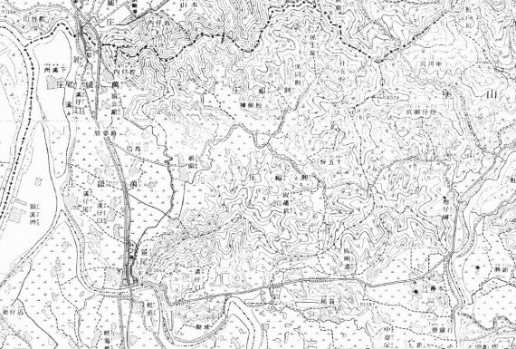
Jingmei was originally inhabited by the Xiulang community of the Pingpu indigenous tribe. In 1729 (the 7th year of the Yongzheng era), the tribe had a conflict with a crowd of Cantonese cultivators led by a man named Liu gaan-ngok, who were setting up Chuansan (Fist Mountain) in the Linkou village (nowadays Gongguan); that conflict saw hundreds of casualties. Five years later, immigrants (from Anxi County of Quanzhou City in the Chinese province of Fujian) arrived in Ketagalan, settling in Wenshan, driving away the Cantonese people, and establishing the Gongguan village (where the Gongguan campus of National Taiwan Normal University, or NTNU, is located nowadays), and their settlement had since spread southward. In around 1740, Xizikou, San Kuai Tso (a community built by three cultivators), and Shiwufen Zhuang (a community built based on 15 capital stocks) were set up, and they would be combined into two villages: Xingfu and Wansheng.
The immigrants at the time might have advanced southward either from the present-day Gongguan or along the bank on the right side of the Xindian River to settle in Gongguan Street and Xizikou, where they would establish the Wan Cheng village. Afterwards, they climbed over the Toad Mountain and built settlements eastward, which would eventually expand and form Shiwufen Zhuang (i.e., the Xing Fu village).
- History behind the name “Jingmei”
Jingmei was originally called “Kingbe” (in which “King” refers to a wooden trough in Southern Min and “Be” means the end). The name was given during the Qianlong era, because Kingbe was located at the end of a big wooden trough bridge installed to deliver irrigation water sent by the Liugongjun canal system (constructed under the supervision of Kuo Hsi-liu, born in 1705 and deceased in 1765), which ran over the Wuli River (nowadays Jingmei River) while channeling water from the Qingtan River in Xindian into crop fields in Taipei. Kingbe was under the administration of Fort Tamsui and subsequently Fort Chuansan in 1812 (the 17th year of the Jiaqing era), which was renamed in 1894 (the 20th year of the Guangxu era) as the elegant sounding “Fort Wenshan.”
When Taiwan was under Japanese rule, Japanese people changed Kingbe to “Kengbe” (King and Keng are similarly pronounced in Southern Min) because King was a rare word in the Japanese language. From the middle stage of the Japanese colonial period onwards, Kengbe was under the administration of the Shinko village of Bunsan District of Taihoku Prefecture. Kengbe became a district of Shenkeng Township of Taipei County following World War II, but it was separated from Shengkeng after redistricting in 1950 and became an independent township, with Muzha established as a county. Yet, because the character “be” in Kengbe, which gives an connotation of “down and out” or “the worst scenery” in Mandarin, did not sound auspicious, Lin Fo-kuo, a member of the Taipei County Council at the time, proposed changing it to “mei” (beauty), an idea that received widespread support—and hence Jingmei Township. Today, when locals in Jingmei pronounce the name of the region in Southern Min, they say “Jingma” rather than “Jingmi.”
In 1968, Jingmei and Muzha were placed under the jurisdiction of Taipei City, designated as Jingmei District and Muzha District, respectively. In 1990, two districts were combined to form the present-day Wenshan District.
- Cultivation history of Xingfu Village (Shiwufen Village)
The earliest land reclamation contract ever found in Wenshan is the one clinched among Hu Hsin-chia, Chien I-chih, and Lo Ku-chin in 1761 (the 26th year of the Qianlong era). One can learn from this contract that a village called “Xingfu” had already been established at the time. In addition, The Chronicles of Taipei County describes how Shiwufen Zhuang was established:
“It took on this name because it was established based on 15 capital stocks contributed by Su Hsing-tsun, Kao- I-chiao, Lin Chia-hsiu, and Yang Yuan-lin from Jide Township of Anxi County, Wang Hsien-tsung and Yen Chung from Jintian Township of the county, Hsu Piao-chung, Hsu Piao-sheng, Chen Wo-chien, and Chen Chien-chih from Shantou Township of the county, and Liu Shih-tang from Shanping Township of the county during the middle part of the reign of Emperor Qianlong.”
The quotation above indicates that 12 people from Anxi County of Fujian Province contributed 15 capital stocks to build Xingfu Village—and hence the village is also known as Shiwufen Zhuang.
A tenant farming agreement written by Chun Hsiao-tzu in 1777 (the 42nd year of the Qianlong era), a landlord based in Hsiu Lang, makes a mention of the place name Shiwufen:
“Shan Pu lies in a mountain top locally known as Shiwufen and faces Lin Bu Sheng Shan in the east.”
Moreover, according to The Chronicles of Taipei County, Hsu Piao-sheng, one of the cultivators of Shiwufen Zhuang, migrated with his cousins Hsu Piao-chung and Hsu Piao-hsing (both mentioned in a book about the genealogy of the Hsu family in Taiwan) to Taiwan and worked with other locals from Anxi County to establish the village. Liu Ping-cheng, the fourth son of the Shiwufen settler Liu Shih-tang, moved to Dapinling in Xindian and established Qizhang; the Lius have since become famous in the local community.
- Geographical limits of the Wansheng village
The village stretches from Chiao Tou (nowadays the junction of Jingxing Road and the end of Section 1 of Xinglong Road) in the east, extends toward Jingmei River and Xindian River in the west, borders with the Toad Mountain in the north, and faces Jingmei River. Today, it spans communities whose names start with “Wang” or “Jing.”
- Old place names in the Wansheng village
- Dinggongguan:
Gongguan Street, located between Wanfu Elementary School and Section 5 of Roosevelt Road, is a community developed at an early time, and most local residents used to carry the surname “Hsu.” The street accommodates an alley characterized by time-honored houses built from red bricks. Moreover, you can see Dinggonguan Fude Temple on the street, which is dedicated to Earth God and stands next to two apartment buildings.
- Panlutian:
Panlutian is located at the front left of NTNU’s Gongguan campus on Alley 23 of Section 4 of Tingzhou Road. The name originates from the presence of two to three shops based somewhere between Dinggongguan (Gongguan Street) and Xiagongguan (in Alley 119 of Section 4 of Roosevelt Road). Panlutian used to serve the now-defunct Wan-Xin Railway; it houses the Gongguan Fude Temple, which is dedicated to Earth God.
- Fanpotso:
Fanposto is located in the vicinity of Wanlong Jiying Temple on Alley 211 of Section 5 of Roosevelt Road. The name originates from the fact that an indigenous old lady lived there at the early stage of the Wansheng village’s cultivation. Moreover, because Shiwufen Zhuang used to yield an abundance of pineapples, which were carried by street vendors through a slope accessed by seventy-two stairs and then sold at Fanpotso and Sankuaitso, the local market in Wansheng was also known as the “Pineapple Store.”
- Hsichoutzu:
Of the two sandbanks in Xindian River that used to lie off the south of NTNU’s Gongguan campus, the lower one partially linked with Jingmei. And that part was cut in the shape of a peninsula by a tributary; it then formed into an area of land (in the neighborhood of the campus) after the water dried up in a nearby riverbed and hence took the name “Hsichoutzu.”
- Toumentou:
Toumentou is located in the junction of Wansheng Street and Section 5 of Roosevelt Road. The second water gate of the Liugongjun canal system is installed in this area. A water gate is pronounced “toumen” in Southern Min, and hence this area is named “Toumentou.”
- Wazhinei:
In the present-day Wansheng Street, around the corner of the Liugongjun canal system, many long-established residents are the descendants of a Chou family that set foot in the Linkou village (which encompassed the vicinity of Gongguan and Shueiyuandi), where there was Fort Wazhinei during the Japanese colonial period. Wansheng Street used to be an aqueduct of the Liugongjun canal system, which traveled over a river in Wazhinei via a small bridge, supplying water to Gongguan.
- Wangwuchang:
In the neighborhood of the present-day Zhiqing Elementary School during the Qing Dynasty, a Wang family struck it rich by cultivating land. The family raised five children, respectively nicknamed Ren, Yi, Li, Zhi, and Xin. Thus, this area was popularly referred to as Wangwuchang.
- Xizikou:
Xizikou is a port located in the vicinity of the present-day Wanqing Qingshui Zushi Temple. The name refers to a junction between Jingmei River and Xindian River. During the early reign of Emperor Qianlong, three individuals—respectively surnamed Gao, Zhang, and Lin—arrived at the port and established settlements, making it the first well-developed place in Jingmei. However, the build-up of silt in river channels would force boats to moor instead at Jianjiaotan, which lies at the intersection of Jingmei Street, and Xizikou’s popularity would thus be diminishing.
- Up Street and Down Street
Jingmei Street is originally called Kengbe Street, which was an aqueduct of the Liugongjun canal system. The street was paved in 1909, when Kengbe Street was repurposed into an aqueduct of Liugongjun. In 1919, Jingmei Public Market was opened. Ranging from the south of pork vendors in the market to a riverside is Up Street, which used to be the busiest street; Down Street originates from the north of the vendors. As river channels fell into disuse, along with the opening of Wan-Xin Railway and roads, Down Street became increasingly populated and it is now busier than Up Street.
- Shimen:
Shimen is located at the junction of Jingxing Road and Muzha Road. Originally the back side of Jingmei Mountain, it was drilled to allow Wulixue Canal to draw water from Wulixue River (nowadays Jingmei River) via Liyu Mountain to irrigate fields in the west part of Taipei, and hence took the name Shimen.
- Zunhou:
Zunhou is located in the vicinity of the present-day Jinghou Street; it lies at the back of Wulixue Canal, hence the name. In the old days, the Liugongjun canal system was known as the “front canal” and Wulixue Canal as the “back canal.” Jinghou Street used to be an aqueduct of Wulixue Canal, but it fell into disuse in 1907, when the Japanese colonial government incorporated Wulixue into Liugongjun.
- Sankuaicuo:
Located in the vicinity of an electrical substation on Jinglong Street, Sankuaicuo is a community built and inhabited by three individuals: Lin Xinqi as well as two partners surnamed Zhou and Chen, all of whom came from Jide Township of Anxi County in Fujian Province.
- Geographical limits of Shiwufenzhuang (Xingfu Village)
The village stretches from Qiaotou (at the junction between Jingxing Road and the end of Section 1 of Xinglong Road) in the west, extends to Mamingtan Mountain (at the end of Section 3 of Xinglong Road and the front of the elementary and high school programs of Taipei Private Tsai Hsing School) in the east, borders with Toad Mountain and Fanglan Mountain, and faces Jingmei Mountain in the south. It sits in a valley facing three mountains, split by Wansheng River, and occupied predominantly by villages whose names begin with the character “Xing.”
- Old place names in Shiwufenzhuang
- Shiwufenkou (Entrance of Shiwufenzhuang): It is the entrance of Shiwufenzhuang, located close to the present-day Jinglong Street when you look from Shiwufen Railway Station.
- Shiwufen: It is the periphery of the center of Shiwufenzhuang, located in the vicinity of Section 2 of the present-day Jinglong Road.
- Shiwufennei (Inside of Shiwufenzhuang): It is a locality that lay within the boundary of Shiwufenzhuang and nowadays spans the neighborhood of the intersection between Section 3 of Xinglong Road and Xingde Road.
- Quaotou (Bridge Head): It is a bridge at the junction of Sections 1 and 2 of Xinglong Road (which is located before Shengan Temple nowadays), which was where Wansheng River used to pass through.
- Tudigongpo (Earth God Slope): It is located in the vicinity of the present-day Xinglong Elementary School on Fuxing Road. There is a slope behind a temple dedicated to Earth God (the temple is nowadays called Fuxing Temple), hence the name.
- Huzinei: It is located in the vicinity of the present-day Xingfu Junior High School on Fuxing Road, and the name refers to its location within a basin (the basin is pronounced like “Hu” in Southern Min).
- Qishierjie (Seventy-Two Stairs): It is located on a slope at the end of Lane 95 of Fuxing Road on the opposite side of the present-day Xingfu Junior High School. It used to be a shortcut for traveling from Shiwufenzhuang to Wansheng Village; the junction of both villages had 72 stairs, hence the name.
- Zhongwacuo (The Middle House): It is close to the junction between Xingde Road and Section 3 of Xinglong Road. It used to be occupied mostly by thatched houses. One of them had its roof covered with tiles and stood in the middle of a road, hence the name.
- Wugongya (Centipede Teeth): It extends from within the present-day China University of Technology. Its surrounding mountains resemble the teeth of a centipede, hence the name.
- Tanyao (or Tanyaokeng): It is located behind Coast Guard Administration of Executive Yuan on Section 3 of Xinglong Road. There, someone used to craft earthenware and produce charcoal, hence the name. This place is marked as “Tanyaokeng” on a map of Taiwan from the Japanese colonial period, and it was where the mining firm Changxing (later renamed “Xinyi”) was based.
- Paxing (Rake): It is located behind the present-day Xinglong Market. Its mountain resembles a farming rake, hence the name. An ancestral shrine of the Xu family lies at the foot of the mountain on the left back side of Xinglong Market.
- Shixing (Lion): It is located in the present-day Xinglong Park and close to the back of Wangzhexian Building. Its mountain resembles a lion, hence the name. This place was where a Liu House was located sometime in the past.
- Huxing (Tiger): It is located behind the present-day Xinglong Elementary School. Its mountain resembles a tiger, hence the name. Its former residents were mostly surnamed Su and Gao.
- Houxing (Monkey): It is located next to Xingde Road, which lies just a short walk away from the Department of Civil Servant Development. Its mountain resembles a monkey, hence the name. This place was originally inhabited by a Kao family.
- Gongshengao: It is located in the hill of Houxing and characterized by plenty of low-lying valleys. It used to be owned by a person called Zhou Gongsheng, hence the name.
- Yangcuo (Yang’s House): It is located on the right side of the present-day Xingde Elementary School. Most residents are surnamed Yang, hence the name.
- Wengcuo (Weng’s House): It is located in Alley 95 of the present-day Fuxing Road. Most residents are surnamed Weng, and hence the name Wengcuo.
- Dingcuoxu: It is located in Alley 216 of the present-day Jinghua Street; residents are predominantly the descendants of Xu Biaoxing.
- Xiacuoxu: It is located in front of Wanlong Zushi Temple in Alley 22 of Section 2 of the present-day Xinglong Road; residents are predominantly the descendants of Xu Biaoxing.

最新自 何文賢 / He Wen-hsien
- 1960年代的景美菜市場
- 己亥年(108年)景美聯合遶境
- 壬辰年(民國101年)景美集應廟迎香慶典
- 壬辰年(民國101年)景美聯合遶境慶典
- 文山興安宮
- 古亭地政事務所
- 未有大樓前的景美街景
- 由景文街看車前路
- 車前路地貌的改變
- 辛卯年(民國100年)北投集應廟至景美迎回保儀
- 原車前路上順泰玩具食品行
- 高選風遺墨
- 景文街林鶴年醫院舊宅
- 景美集應廟豬公祭典(一)
- 景美舊橋封橋待拆除
- 開道碑重置揭幕
- 瑠公圳舊道與新道會合點
- 興隆市場
- 1970年以前景美的工廠及公營機構
- 1980年以後景美的工廠及公營機構
- Liugong Bridge: the First Reinforced-Concrete Bridge in Taiwan
- Expected Changes for the Landscape of Jingmei After 2020
- Landscape of Jingmei during 2000–2020
- Landscape of Jingmei during 1980–2000
- Landscape of Jingmei during 1960–1980
- Landscape of Jingmei before 1960
- The Stealthy Wansheng River
- Turning Jingmei River Channels into Parks
- A Potential Archeological Site of Shiwufen
- Xingfu Village Monument
- Earth God Temple in Jingmei
- History of Wan-Xin Railway
- Liugongjun and Wooden Trough Bridge
- History of Jingmei Bridge
- Coal Mining in Wenshan District
- Important Infrastructures in Wenshan District from the Past
- Changes in Jingmei’s Geography and Road Infrastructure
- 霧裡薛圳圳路
- 景美街1號與2號距離遠
- 景美行政變遷
- 景美老街拱形騎樓元素
- 都更下的景美街困境
- 2000年至2020年景美地景變遷
- 1960年以前景美地景樣貌
- 1960年至1980年景美地景變遷
- 1980年至2000年景美地景變遷
- 2020年後景美地景變遷的期待
- 景美街商業土地使用分區
- 原貌仍在的泰興染織廠
- 中農化工廠基地變遷
- 1980年以後景美的工廠及公營機構
- 1970年以前景美的工廠及公營機構
- 興福庄「建塚記念碑」
- 金獎外觀興隆市場
- 臺北花木批發市場
- 疑似十五份遺址
- 會元洞清水祖師廟
- 景美福興宮
- 景美瑠公圳暨成巷道
- 景美忠勤三莊新面向
- 景美「賴氏萬壽塔」
- 頂公館福德宮
- 消失的興福庄浚溝修路石碑
- 和伯公紀念會館
- 台北江西會館及萬壽宮
- 在興隆路的台北畜產運銷公司
- 在景美的古亭地政事務所
- 文山興安宮
- 文山溪洲福德宮
- 三福街古道
- 十五分火車站
- 十五分庄舊地名
- 木柵集應廟保儀尊王巡境貓空
- 甲午年(103)木柵集應廟巡境慶典
- 景美集應廟豬公祭典
- 仙跡岩拾遺
- 仙跡岩的民間信仰
- 仙跡岩舊八景
- 龍吃水的地理景觀
- 圳後山的圖根點
- 景美山的三角點
- 百年金龜樹生病了
- 景美其他的老樹
- 景行公園的老樹
- 景美養工處老樹
- 巷內的魯花樹
- 興安宮的老榕樹
- 景豐街的老樹
- 萬有公園的老樹
- 萬和公園的老樹
- 景美國中的老樹
- 景美國小附近老樹
- 景美國小的老樹
- 萬新鐵路的歷史
- 景美聖方濟沙勿略堂
- 景美的西方教會彙總
- 味自慢居酒屋
- 義興樓食堂
- 景美的春燕
- 萬盛溪舊溪床旁的春燕
- 你目前位置:
-
首頁

-
Wenshan Studies
- History of Jingmei